Today is the 200th anniversary of the town of Columbus, Alabama, being officially recognized as part of the state of Mississippi and not Alabama. On Jan. 3, 1821, Mississippi Gov. George Poindexter announced that “a considerable population on the waters of the Tombigbee formerly attached to Alabama fall within the limits of this state.” On Feb. 10, 1821, the Mississippi Legislature chartered the Town of Columbus, Mississippi.
The Cedars c.1818 is the only building that has survived from that early date. Though in the city limits now, it was located on the Military Road about two miles north of town in 1821. However, other remnants of the original town do survive.
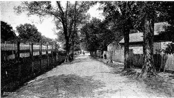
We see those remnants every day without realizing we are looking at the footprints of Columbus from more than 200 years ago. They are the offset streets and city blocks across Southside and along Military Road and Waterworks on Northside. They are the paths of roads that predate the city’s 1821 street grid.
When Columbus was established as a town in 1819, there were few roads in the area. The principal highways were the Military Road, the Upper Tuscaloosa Road, the Marion Court House Road (Old Aberdeen Road) and the Pickensville or Lower Tuscaloosa Road. These roads predated the street grid that was laid out on top of them in July 1821. That overlay resulted in streets that cut across or dog-legged around city blocks. Those early roads were the city streets until a survey creating lots and blocks with streets was completed in the summer of 1821.
The Military Road construction began in 1817 and was completed in 1820. It is the oldest road within Columbus. Across the Tombigbee, it tied into the St. Stephens Trace, which by 1813 was a wagon road connecting Chickasaw villages at present day Tupelo, through John Pitchlynn’s at Plymouth Bluff with St. Stephens on the Tombigbee north of Mobile. It was the Military Road’s Tombigbee ferry location that became the site of Columbus.
Military Road still follows its original roadbed into Columbus until its intersection with Third Avenue North. There it cut through the block where First Baptist Church is located, angling southwest toward the intersection of Seventh Street and Second Avenue North. Military then turned west and proceeded down present day Second Avenue North to the Tombigbee. Second Avenue was originally named Military Street. It is the old road slicing through city blocks that creates the series of small triangular blocks that one encounters driving along Military on Northside.
The Columbus post office was established on March 6,1820, and by January 1821, there were two post roads into Columbus. These were the roads designated by Congress upon which mail was carried and were the principal highways of the time. The two were the Military Road and what became known as the Upper Tuscaloosa Road.
The Upper Tuscaloosa Road went from Marion Courthouse through Columbus to Tuscaloosa. Marion Courthouse was the county seat of Marion County, Alabama, and was the location of residence of Henry Greer. It is now the site of Columbus Air Force Base. Shortly after the organization of Monroe County, Mississippi, there in 1821, the settlement moved across the Buttahatchie and was named Hamilton. The Upper Tuscaloosa Road survives as Highway 50 East and Waterworks Road and the road to Henry Greer’s is Third Street North and Old Aberdeen Road.
In 1823, the post road to Tuscaloosa was changed to the Pickensville or Lower Tuscaloosa Road. The route of that road across present-day Southside Columbus is evidenced by the offset streets between the river and MUW where the street grid was adjusted to account for the existing road, thereby leaving offset city blocks.
The offset at the south end of downtown that dog-legs around the Light and Water Department Building results not from an old street but from a mismatched survey. The original city limits on Southside passed along Fourth Street at the Light and Water building, but the street grid of Barry’s 1830 addition did not match the existing street grid at Fourth Avenue and Fifth Street South. Thus, we now have that dog-leg.
The February 1821 legislative act creating Columbus, Mississippi, appointed commissioners who were to meet on June 1 and lay out the town. Though Columbus had been established more than a year earlier, no survey or plat of the town had been made.
At the June 1 meeting the commissioners, William Cocke, Silas McBee, David Kincaid, William Leech, John Deck, Thomas Townsend and Gideon Lincecum, elected William Cocke as their president, authorized the purchase of “four hundred stakes suitable for corner posts to the lots” and appointed Joshua McBee to survey the town, receiving $1 for each lot surveyed.
On July 13,1821, “Mr. McBee presented a plat of the Town agreeably to the order of the Commissioners of said town a survey of two hundred and eleven lots containing sixty six feet in front and one hundred and forty five feet back — Main street running north seventy three degrees East is the Meridian line of said plat which contains three parallel streets to be called and known as follows: the first, Broad Street; the first north from Broad Street, Military Street & the first South from Broad Street, Washington Street — The cross streets shall be called & known as West, Center, and East streets.” Broad Street is now Main Street and Center Street is Market or Fifth Street.
The next time you drive down a Columbus street and see a miniature triangular block or a weird dog-leg street, remember the triangular blocks and dog-legs that you are looking at are footprints from Columbus’ earliest days.
Rufus Ward is a Columbus native a local historian. E-mail your questions about local history to Rufus at [email protected].
You can help your community
Quality, in-depth journalism is essential to a healthy community. The Dispatch brings you the most complete reporting and insightful commentary in the Golden Triangle, but we need your help to continue our efforts. In the past week, our reporters have posted 33 articles to cdispatch.com. Please consider subscribing to our website for only $2.30 per week to help support local journalism and our community.