JACKSON — The Mississippi Blues Trail mobile app is now available for download from the iTunes® store. The free app, currently available only for iPhones, has a variety of features to allow users to navigate the trail and create customized itineraries to explore Mississippi”s musical heritage.
“Blues enthusiasts will be able to map their travels along the trail and easily buy music from these Mississippi artists,” Gov. Haley Barbour said. “The mobile app is an innovative way for visitors to tour and experience the Mississippi Blues Trail.”
Funding for the development of the project was provided by a grant from the Mississippi Department of Transportation, the Federal Highway Administration and the Mississippi Development Authority”s Tourism Division. Greenwood-based Hammons and Associates acts as project manager for the Mississippi Blues Trail and partnered with Starkville-based Concept House in developing the new app.
“I think the really exciting part of the new Blues Trail app is the appeal it will have for younger generations. It”s a remarkable way to combine music, geography and the astonishing history of the impact of Mississippi”s blues musicians on world music. It”s a winner, and it sets a high bar as a new cultural heritage tourism asset,” said Bill McPherson, chairman of the Mississippi Blues Commission.
“This fun and user-friendly tool is another resource to promote Mississippi”s diverse cultural heritage and attract visitors to the state to experience the sights and sounds of the True South for themselves,” said Mary Beth Wilkerson, director of MDA”s Tourism Division.
Menu
The main menu for the Mississippi Blues Trail app consists of six main buttons:
- Map – Powered by Google Maps, users can see the location of every marker, zoom in to a specific site and see an individual page about that marker.
- Timeline – By scrolling and expanding, users can see which artists were contemporaries and what historical events were happening associated with blues music.
- Markers – With this link, users get several options: first an alphabetical list of markers appears; then buttons at the top of that page allow users to sort by distance from their location. This is especially helpful to travelers who want to locate nearby markers. At a specific marker link, users have the option to add it to their itinerary. There are also direct links to the iTunes store, so users can preview an artist”s song and then purchase and download the music on the spot.
- Itinerary – After markers are added to the itinerary, users can see the route mapped for them, including turn-by-turn directions to each site.
n People – This button shows individuals mentioned on markers and links back to the pages they are associated with.
- Videos – Users can view a 4 1/2-minute introduction video about the Mississippi Blues Trail and several videos for specific markers around the state.
Another recent addition to the Blues Trail program is the use of QR (or “quick response”) codes on certain markers that allow visitors to scan them with any smartphone and view the same videos that are available on the mobile app. For those who prefer not to use the QR codes, links to the films are also noted on the markers so visitors can manually type them into their phone or laptop browser.
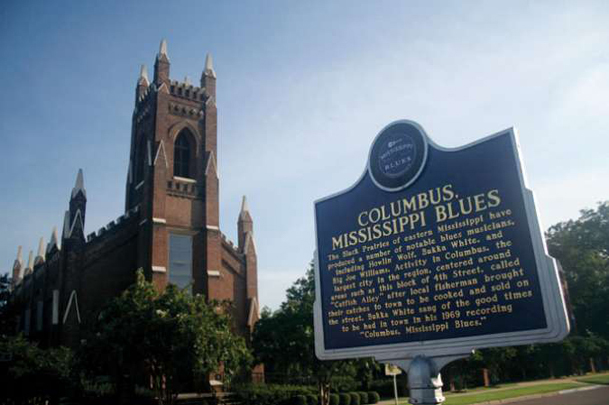
With approximately 135 markers, the Mississippi Blues Trail is a museum without walls taking visitors on a musical history journey through Mississippi and beyond.
Area markers are located in Columbus, West Point, Crawford, Macon and Aberdeen.
For more information, visit msbluestrail.org or explore the official Mississippi Development Authority”s Tourism website, VisitMississippi.org.
You can help your community
Quality, in-depth journalism is essential to a healthy community. The Dispatch brings you the most complete reporting and insightful commentary in the Golden Triangle, but we need your help to continue our efforts. In the past week, our reporters have posted 32 articles to cdispatch.com. Please consider subscribing to our website for only $2.30 per week to help support local journalism and our community.